Ground · Sheet G
Read your ground.
Type an address. Public lidar draws the lot’s height, a contour every foot, and the lines the rain runs along. Then lay out the yard on it, to scale.
Your own place: read it, sketch what you want, and send it to Noon.

Sample · Japanese Tea Garden
- Lot
- Height
- Contours
- Water
- Lot
- A city park, so no lot line: read 180 ft around the garden
- High to low
- 49.5 ft
- It falls toward
- The east, 35.5 ft across the garden (9.9%)
- Rain leaves
- Mostly on the south-east side
- Rain from next door
- About 53,750 sq ft of ground drains into it
- Where it stands
- 3 low spots hold rain; the largest, about 35,200 sq ft, fills 71 in deep before it spills
USGS 3DEP lidar, TX Central B2 2017, 1 m · USDA NAIP aerial
Design bar · Sheet G-1
Lay it out on your ground.
Tap a piece to put it on the read, then drag it where it goes. Everything is drawn to scale: a live oak is 30 ft across.
Nothing laid out yet.
Send this to NoonWhat this is, and isn’t. The ground as USGS flew it with lidar, points about a metre apart and true to about four inches, with the trees and buildings lifted out. It shows how a lot falls and where the rain goes. Anything built or graded since the flight isn’t in it, and neither are pipes and drains, so a low spot here may already drain. It can’t set levels to the inch. That is what the scan is for. The address goes to Noon’s address finder, which keeps the map point and never the address; the read itself happens in your browser, from public maps.
The scan · Sheet G-2
Then we scan it.
The read above is lidar flown over the city years ago, a height about every 3 ft. The scan is the yard as it stands today, walked with an iPhone: a height every 4 in, a contour every 6. Here is one front yard, from the scan to the truck.
I · Scan
Walk it once.
Noon Scan runs on an iPhone Pro, whose LiDAR sensor reads the ground as you walk: the edge first, then lanes about 6 ft apart, then in close where it matters. It keeps the ground, the photos and a film, and sends them to Noon with one press.
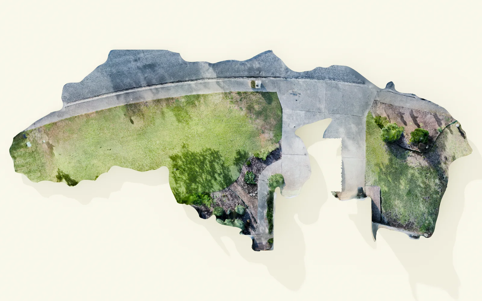
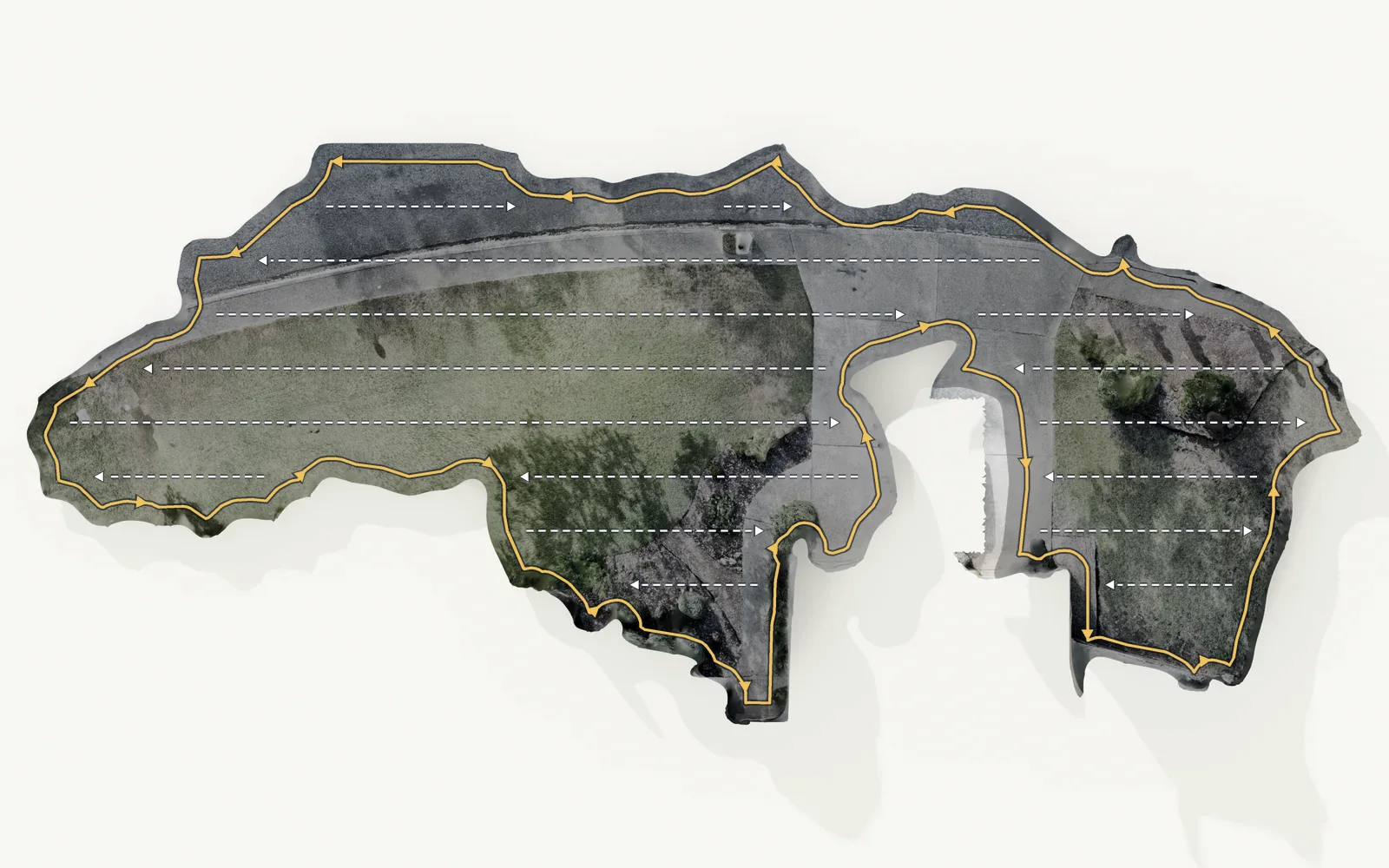
- Scanned
- 5,337 sq ft of ground
- Detail
- A height about every 4 in
- Set to
- True north, and the public lidar’s heights
- The phone
- An iPhone Pro with LiDAR, 12 Pro or later
II · LiDAR and Water Maps
Read the ground.
The scan is drawn out as maps of that ground: its height, a contour every 6 in, the lines the rain runs along, and the hours of sun on the longest day and the shortest.
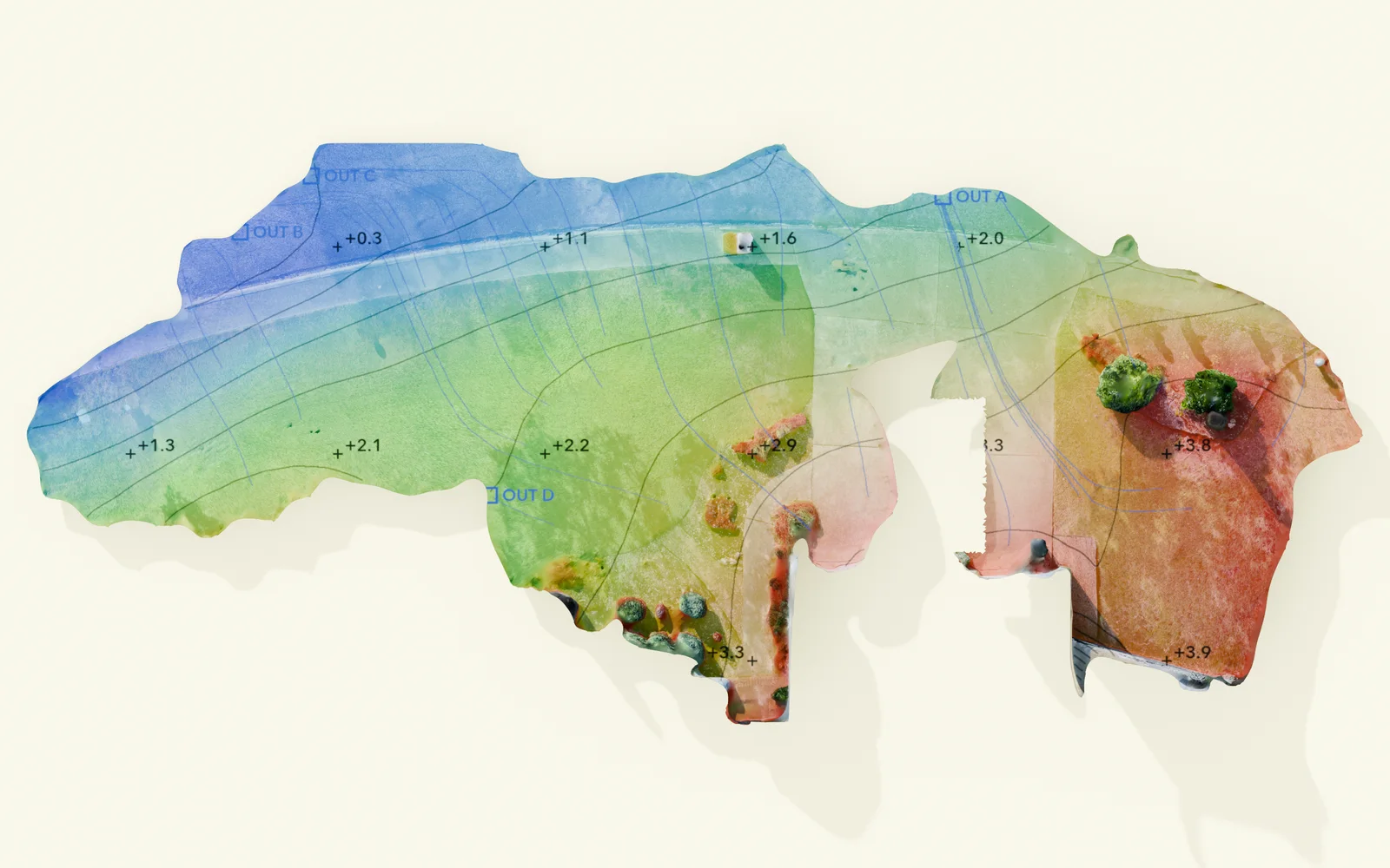
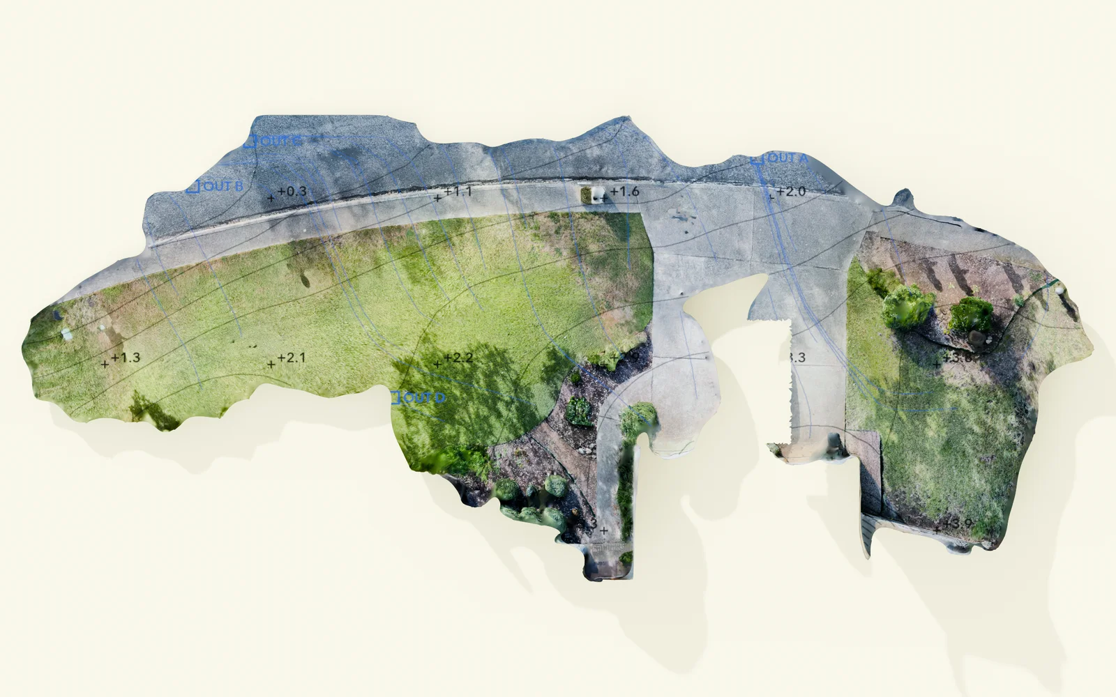
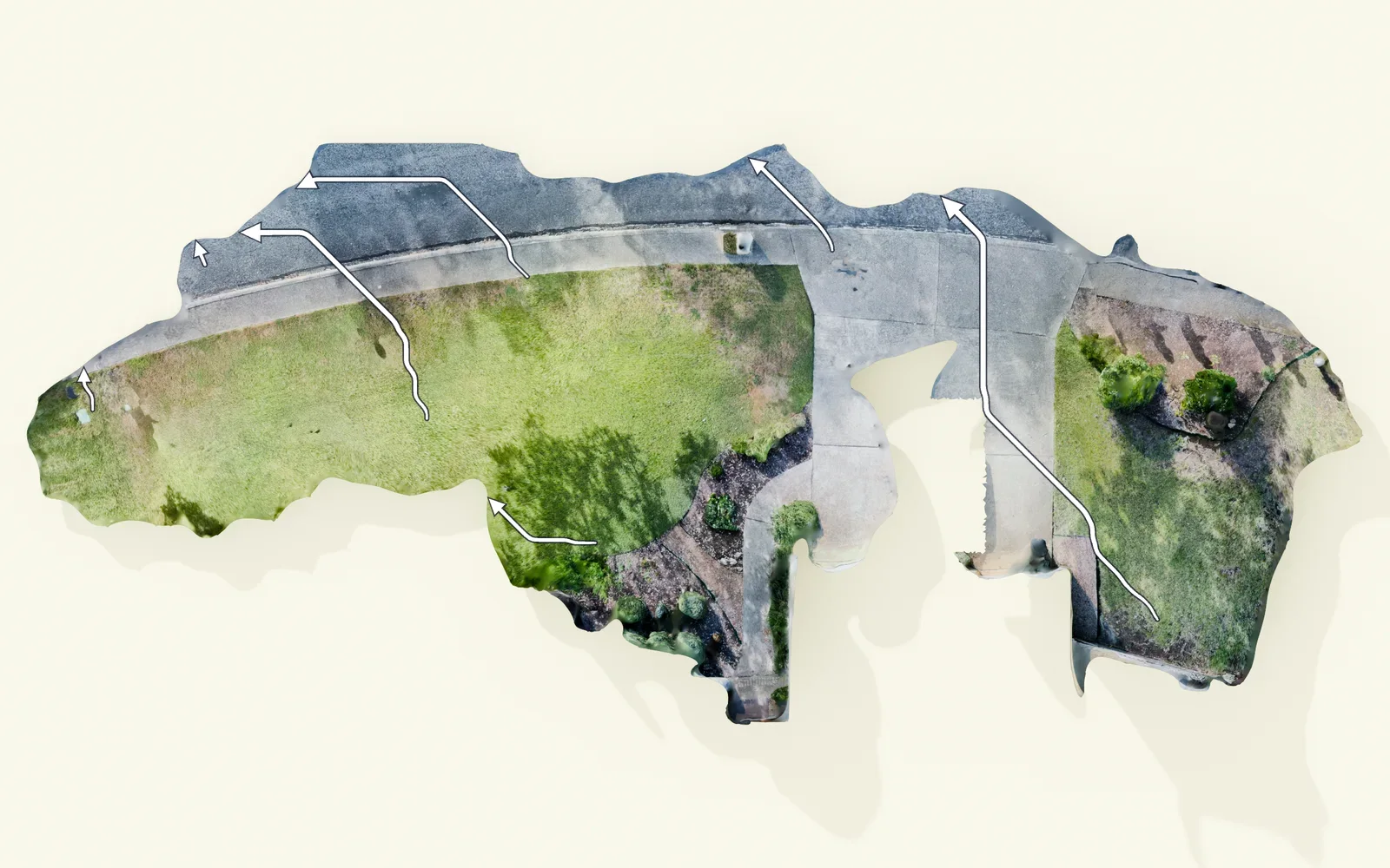
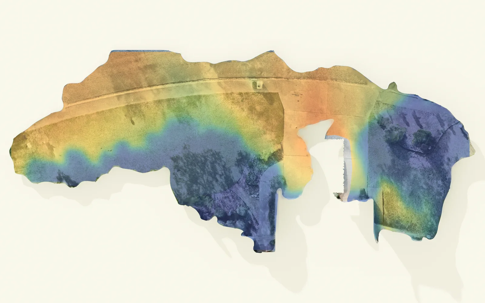
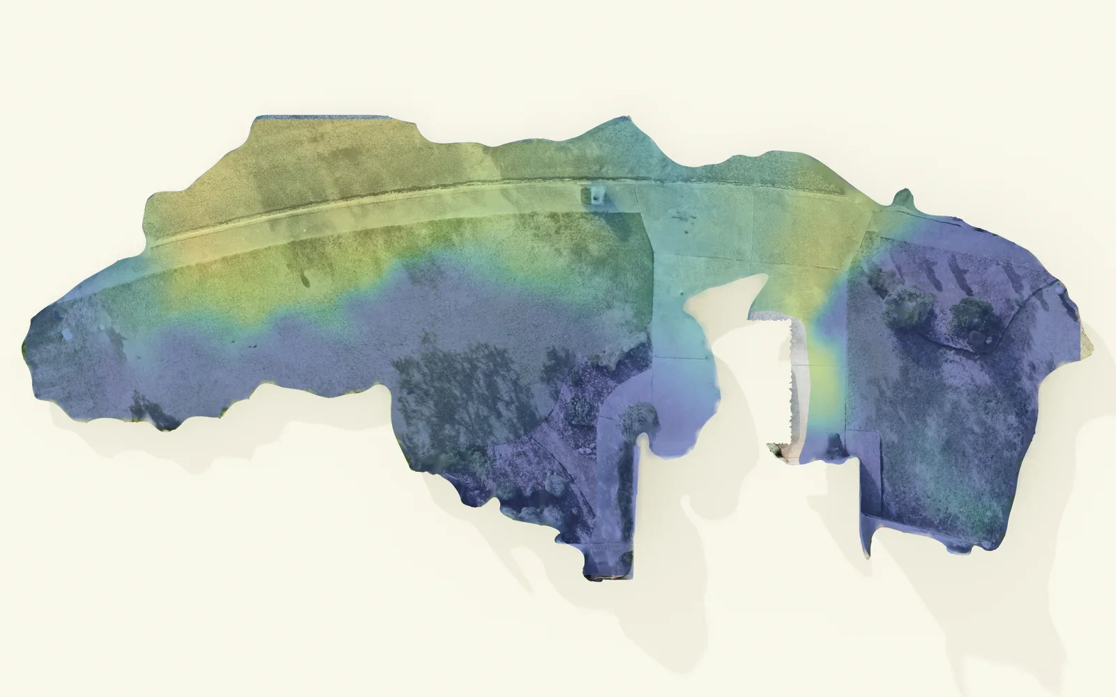
- High to low
- 3.9 ft
- It falls toward
- The street, to the northeast
- The rain
- About half gathers into the white lines, most of them out to the street; the rest crosses as a sheet
- Where it stands
- Nowhere holds 2 in or more
- Sun, June 21
- About half the yard gets 6 hours or more
- Sun, Dec 21
- Under a fifth of it does
Sun: the house and the trees as public lidar caught them in 2017, turned to the scan’s true north.
Turn this yard in 3DIII · Design
Draw it on that ground.
The design is drawn on the scan itself, so it can be read against the maps before anything is built.
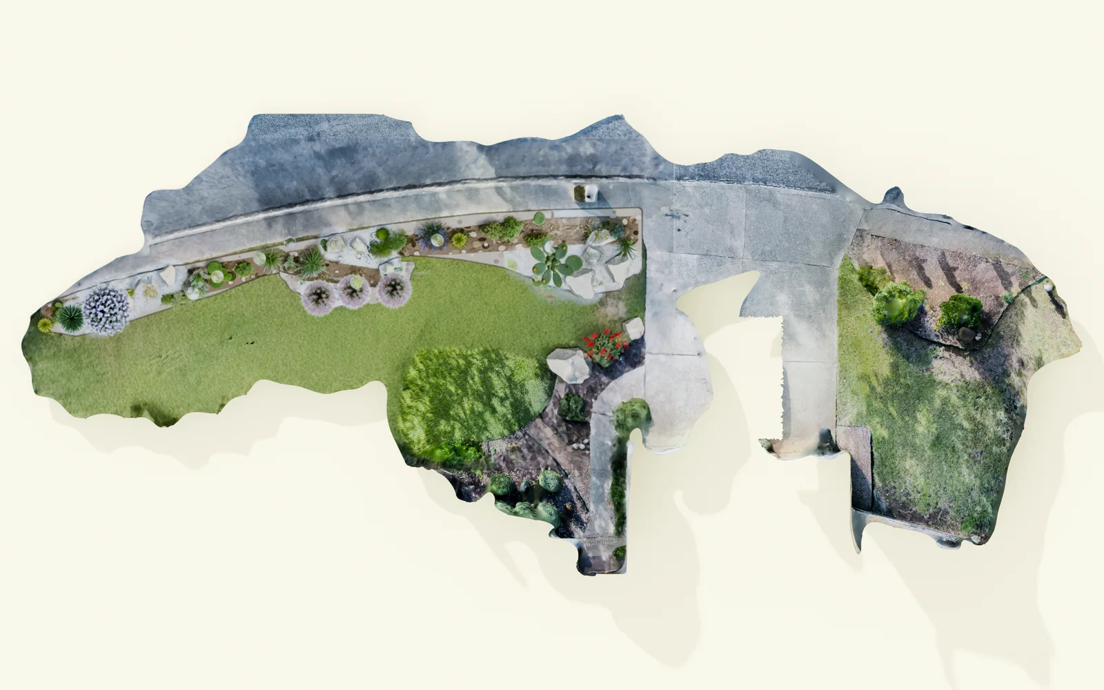
- The bed
- Runs along the low side of the lawn; about a quarter of the yard’s rain runs into it on the way to the street
- Full sun
- Prickly pear, cactus and Texas sage sit in about 8 hours of June sun
- Shade
- The inland sea oats, under the trees, get less than one
IV · Delivered
Counted off the drawing.
The planting plan comes off the same drawing: each plant where it goes, the boulders at their size, the bed of stone. That list is what gets delivered.
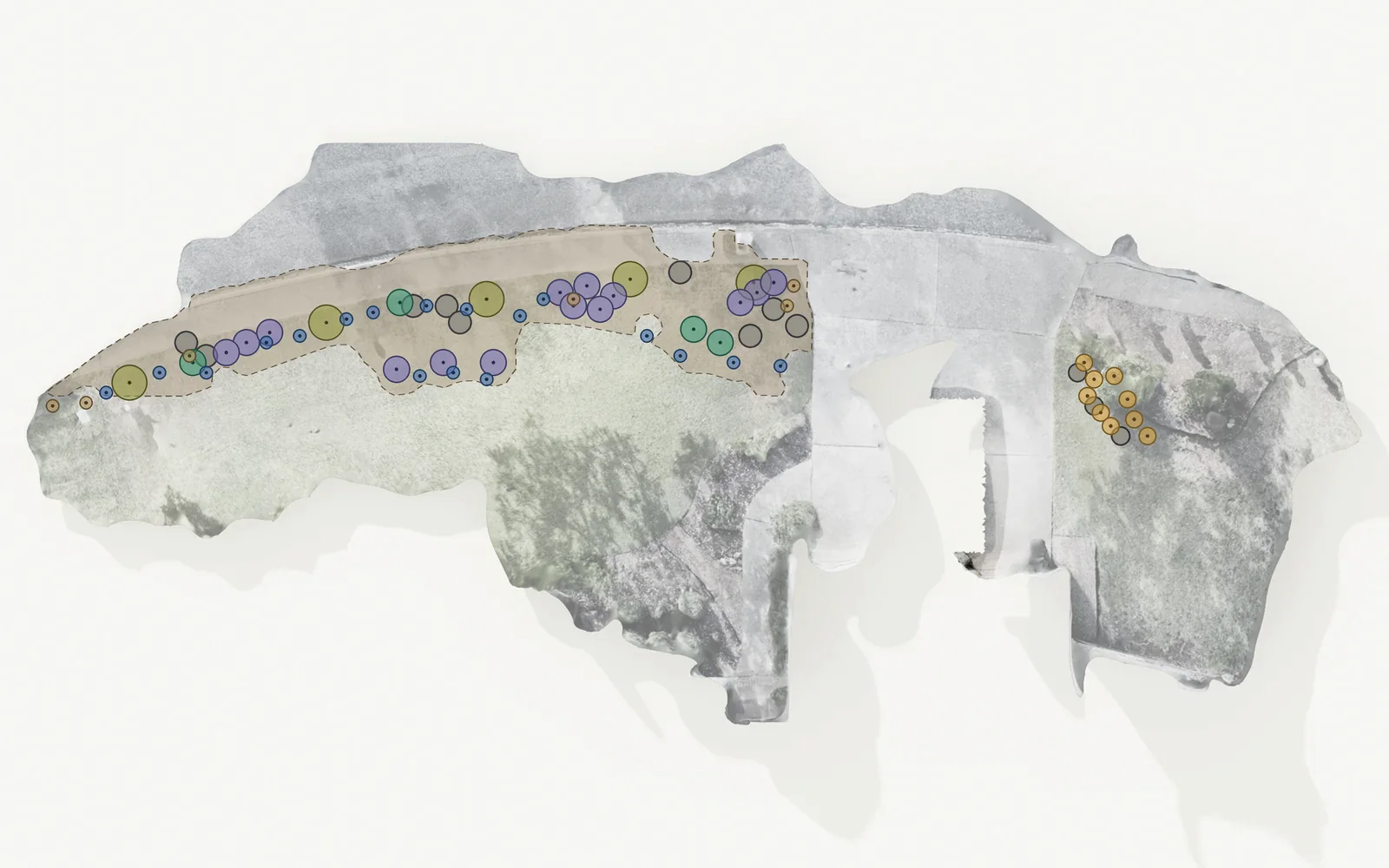
| What | How many |
|---|---|
| Skullcap | 18 |
| Muhly grass | 14 |
| Inland sea oats | 9 |
| Cactus specimens | 6 |
| Texas sage (cenizo) | 5 |
| Prickly pear | 4 |
| Plants | 56 |
| Outcrop boulders, 24 to 30 in | 9 |
| Island boulders, 18 to 24 in | 3 |
| Texas blend river rock, 3 to 6 in | The front bed |
Your yard · Sheet G-3
Send it to Noon.
Your read and your layout come with it. A designer answers, usually the same day, then scans the yard as it stands and draws the design on that ground before anything is built.
Ground · Sheet G
The ground, read first.
Before a line is drawn, the ground is read: how it falls, where the rain runs, where it stands. Every Noon design starts there.
- Prepared by
- NOONDesign ☉ Build ☉ Systems
- Issue
- 09.2026
- Studio
- San AntonioAustin · By commission anywhere
- Sheet
- G